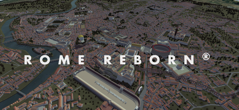
The Rome Reborn project set out to create a digital model of ancient Rome at the height of it's power in 320 AD. The first version of the model containing digital terrain and around 7000 buildings was completed in 2007.
Version 2 (or Rome Reborn 2.0 as they have taken to calling it) was debuted at Siggraph earlier this year. Firstly the version 1 models were imported into Procedural's amazing CityEngine software. Under the supervision of archaeologists the models were refined and the detail improved and I think the results are really amazing.
The model data is available over the internet in a couple of ways. Using the Reality Server interface (authored in Flex) users can select a view of the city and have it rendered on the fly by Mental Images RealityServer and have it returned to them.
The other way to access the data was announced by Google at a press conference in Rome earlier today. Ancient Rome 3D is to be the first historical 3D geographical layer in Google Earth. The KML Collada models in Google Earth are obviously not as detailed as the full Rome Reborn 2.0 models but they may be of interest to any Papervision3D developers looking for ready-made old buildings.